
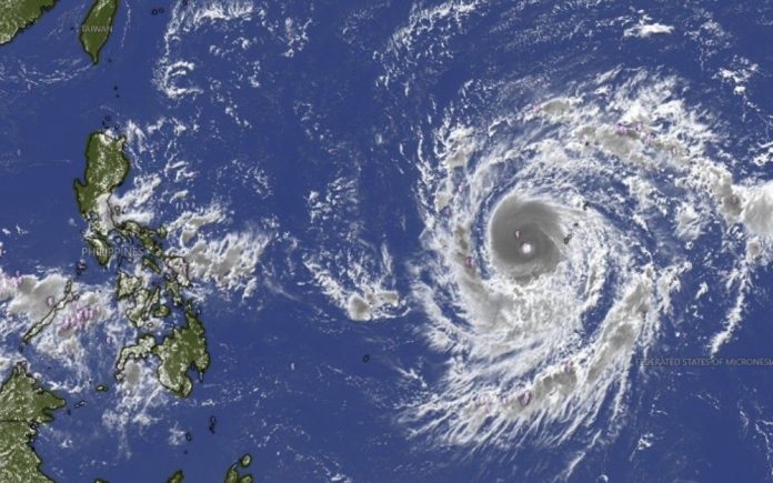
The Philippines is monitoring the approach of Super Typhoon Champi, a powerful tropical cyclone expected to enter the Philippine Area of Responsibility (PAR) on Tuesday, October 20, while still packing super typhoon-strength winds, according to PAGASA.
As of 11 a.m. Sunday, October 18, the cyclone was located approximately 2,090 kilometers east of southeastern Luzon, with maximum sustained winds of 185 kilometers per hour and gusts reaching 230 kph. Champi remained outside PAR but was moving westward, drawing closer to the country’s eastern monitoring boundary.
Once inside PAR, the cyclone will receive the local name Rosal. PAGASA expects it to maintain super typhoon intensity upon entry before gradually weakening after reaching its peak strength. Its projected movement is generally west-northwestward toward Taiwan, although changes in its track and intensity remain possible.
While Champi is not yet directly affecting the Philippines, PAGASA warned that tropical cyclone wind signals could be raised over northern and eastern portions of Northern Luzon and parts of the Bicol Region as early as Monday evening or Tuesday morning. The weather bureau said Signal No. 3 or 4 could be the highest warning level issued during the cyclone’s approach, depending on its development.
The developing weather situation also calls for close monitoring in communities vulnerable to strong winds, flooding, landslides, and dangerous sea conditions. Residents are advised to secure loose outdoor materials, inspect roofs and drainage systems, prepare emergency supplies, and follow announcements from local disaster response offices.
For coastal communities and those planning sea travel, updated marine advisories will be particularly important as the storm approaches. Fisherfolk, vessel operators, and travelers should check official warnings before departing and avoid sailing when authorities declare conditions unsafe.
Champi’s entry into PAR does not automatically mean it will make landfall in the Philippines. However, its strength and projected proximity make early preparedness essential, especially for communities in northern and eastern Luzon.
PAGASA continues to monitor the cyclone’s movement, with further advisories expected to clarify which areas may experience its strongest effects in the coming days.