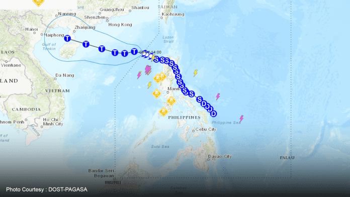
MANILA – The country is likely to experience two more tropical cyclones this month following destructive Severe Tropical Storm Enteng which left the Philippine Area of Responsibility (PAR) midweek, the weather bureau said Friday.
Philippine Atmospheric, Geophysical and Astronomical Services Administration (PAGASA) weather specialist Ana Clauren-Jorda said a low-pressure area (LPA) is being monitored near PAR.
“This could possibly enter PAR and develop into a tropical cyclone next week,” she said during the Bagong Pilipinas Ngayon briefing over PTV-4.
The possible weather disturbance is forecast to enhance the southwest monsoon, which would bring rains across Luzon, particularly in Metro Manila, and the island’s western section, Jorda added.
She said the other possible weather disturbance is still far from PAR.
“Currently, cloud clusters are forming. We expect that by mid-September, this would develop into a tropical cyclone and enter PAR,” she said.
PAGASA is expecting this to move northwestward. Although not expected to make a landfall, Jorda said this possible third cyclone for the month will also enhance the southwest monsoon.
Jorda said the southwest monsoon continued to bring heavy rains in some areas of Luzon on Friday.
Earlier, Ipo Dam’s gate was opened at 0.30 meters. As of 4 p.m., its water level was at 100.56 meters, 0.02 meter higher compared to the level as of 8 a.m., but still within its normal high level of 101 meters.
Jorda urged the public to monitor PAGASA’s social media accounts and websites for timely weather information. (PNA)

