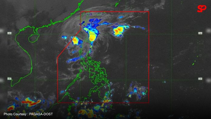
MANILA – Pepito (international name Man-yi) has weakened into a severe tropical storm (STS) and is about to exit the Philippine Area of Responsibility (PAR), the weather bureau said Monday.
Pepito packing maximum sustained winds of 110 km per hour near the center and gustiness of up to 135 kph. was located 270 km. west of Batac, Ilocos Norte as of 10 a.m.
“Pepito is very near the boundary of PAR and would likely exit this afternoon,” Veronica Torres of the Philippine Atmospheric, Geophysical and Astronomical Services Administration (PAGASA) said in a briefing before noon.
Despite this, Torres said several areas remain under tropical cyclone wind signal no. 1 and will experience strong winds: Ilocos Norte, Ilocos Sur, La Union, the western portion of Pangasinan (Burgos, Dasol, Sual, Mabini, Binmaley, San Fabian, Dagupan City, Lingayen, Labrador, City of Alaminos, Bolinao, Anda, Bani, Agno, Infanta, Bugallon, Mangaldan), and the western portion of Abra (Danglas, Bangued, Langiden, La Paz, Pidigan, San Quintin, San Isidro, Pilar, Peñarrubia, Villaviciosa, Lagayan).
She also noted that moderate to heavy rains are forecast in Batanes.
“Landslide is possible in highly susceptible areas,” Torres said.
Meanwhile, at 8 a.m., PAGASA said storm surge threats on coastal areas ceased since Pepito moved away from the landmass.
Gale warning is hoisted over the northern seaboard of Northern Luzon. Sea travel is risky for all types or tonnage of vessels, PAGASA said. (PNA)

